While I’ve lived in Chicago more than 25 years, and ride transit almost every day, the idea of traveling from one end of a line to the other end had never occurred to me. So when my friend and colleague Kathleen Brown, Chairman of Investment Banking for the Midwest Region for Goldman Sachs, suggested we do just that, I jumped at the chance. Following the predictable calendar dance, we carved several hours out of the middle of Halloween day to ride the entire Red Line.
Armed with MPC Research Assistant Jason Brown’s terrific briefing materials, we boarded at Jackson & State heading south. My materials reminded me that the State Street subway dates back to FDR’s New Deal era and the Works Progress Administration, but it’s only been since 1993 that the Red Line has connected from 95th Street on the South all the way to Howard Street on the North. There’s not much to see in the subway tunnels, other than to notice the dramatic variation in lighting, noise, and attractiveness between some stations which have been rehabbed over the past couple decades, and those that are stuck in a time warp. I long for more individualized character for stations – both subway and elevated – so that they can be attractive and immediately recognizable icons, like the mosaics that have recently beautified several Lake Shore Drive underpasses. There’s little evidence of Chicago’s rich and varied neighborhood character in the stations, though I know local community arts groups would be up to the challenge!
I can’t possibly capture all the memorable moments, so will choose just a few to share. We emerged from the underground near Chinatown, marveling at the expansion of the footprint of that community since the 1960s, and quickly arrived at the Sox-35th station. Thankfully, it does deploy innovative design that celebrates nearby U.S. Cellular Field and the Illinois Institute of Technology. But, let’s be real – transit-oriented development around stations in the median of the Dan Ryan, one of the busiest interstates in the country, is not your typical challenge.
Kathleen spied a couple carrying a tourism map exiting the train two stops later at Garfield and we both wondered where they were heading. If their destination was Washington Park, Frank Lloyd Wright’s Robie House, or the University of Chicago, I commented, how much easier (and more attractive) their trip could be in the future if Chicago implements a 10-route Bus Rapid Transit network including service on Garfield Blvd.
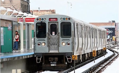
The 95th Street station is one of the few truly multi-modal stations – and it needs to be to handle more than 12,000 riders on an average weekday. You can transfer to 18 CTA and Pace bus lines, or use the indoor bike storage, all for smoother connections. Mayor Emanuel and the Developing Communities Project have been among the most energetic proponents of an extension south to 130th, which would add four new stations serving neighborhoods that have only infrequent Metra and slower bus service.
We re-boarded and headed the other direction, thinking about how different the view to the east was through the 1990’s, with dozens of CHA high rises, trapping thousands of families in substandard housing and blocking access to the lakefront. Today, all are demolished. The land is available, but the financing for projects like MPC Board member Quintin Primo’s mixed-used Metropolis at 39th and State is as challenging as ever.
Emerging from the subterranean murkiness near Armitage, Kathleen, a recent transplant to Chicago, was struck by the density and proximity of homes to the tracks. Each station tells a story because it’s part of its surroundings. Wilson is one which audibly cries out for help, with uneven wooden platform planks and metal pylons that look like their tops were decapitated – and they might decapitate you if you stumbled into one. The CTA has heard those cries, recently releasing an RFP for development around the station. And the $1 B for Red Line upgrades, including more than $700 M from the state that Gov. Quinn and Mayor Emanuel just announced, will be put to good use at stations all along this well-traveled corridor: more than 121,000 riders each weekday.
There are many other visual flashbacks of our trip past the pan-Asian Argyle corridor, the TOD-ready Berwyn stop, and the Employer-Assisted Housing-linked Loyola station, but my stomach is reminding me of our stop at Howard. Tragically, there are no internal connections to the nearby malls, but we navigated our way west on Howard St. to “Good to Go”, a Caribbean-American restaurant recommended by Rogers Park Business Alliance’s Kimberly Bares. If you go there for lunch or dinner, both the jerk pork and jerk chicken – and plantains – were delicious.
That’s it for my travelogue of a transit line that truly is one of the City of Chicago’s backbones – a workhorse worthy of massive reinvestment and a roadmap for re-envisioning vibrant neighborhoods along its spine. I recommend the ride!