Flickr user Don Harrison
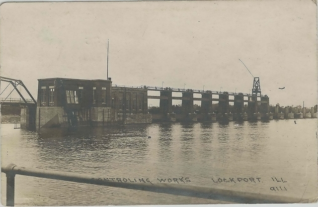
The Lockport Lock at the western end of the Chicago Sanitary and Ship Canal, which has a 5.8-foot change in elevation over its 26-mile length.
 By MWRDGC Commissioner Debra Shore
 - October 14, 2013
Here’s a fascinating fact for you: Over the 26-mile length of the Sanitary & Ship Canal, extending from the South Branch of the Chicago River to the Des Plaines River near Lockport, Ill., the drop in elevation is only 5.8 feet. What does that mean? Well, we know water flows downhill and much of stormwater management is an attempt to move water away from places where it causes flooding or poses problems. But in Chicagoland, there is no downhill! We live in a flat, swampy place. So when we seek to pump water from one place to another to solve flooding problems, it doesn’t have anywhere to flow to.
This salient feature of our landscape affects how we manage stormwater and suffer from flooding. I am happy to report that the Board of Commissioners of the Metropolitan Water Reclamation District recently adopted a Watershed Management Ordinance for suburban Cook County. Go ahead and give a shout! This ordinance, which you can review or download here, establishes uniform stormwater management regulations in order to prevent future commercial, municipal and residential development and redevelopment projects from exacerbating flooding and to protect our rivers and streams from the deleterious effects of urban runoff.
Paved roads, parking lots, walkways and buildings make cities livable, but they also reduce the amount of land on which water can be absorbed, and lead to increased flooding in the absence of reasonable regulations and protections.
The ordinance passed by the Board on Thursday, Oct. 3, was many years in the making, incorporated considerable revision and public participation and brings Cook County in line with neighboring counties in setting sound, science-based standards to manage stormwater on parcels of a certain size (three acres for commercial developments or redevelopments; five acres for multi-family residential developments).
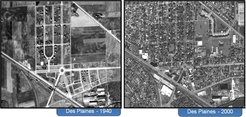
Unfortunately what we see is that unchecked or unregulated development upstream has led to increasing flooding and property damage downstream. When these houses along Big Bend Drive in Des Plaines, Ill., were built, they did not lie in the floodplain:

Yet while the population of Cook County increased approximately 4 percent between 1940 and 2000, building on the land has increased 40 percent. By paving over the landscape, we’ve given rain nowhere to go. Now, we estimate that 95,000 people in Cook County live in the floodplain. That’s a problem because with the more intense rainstorms we have been experiencing, these homeowners suffer time and time again.
The photos above show the changes in land use in Des Plaines over 60 years. Now, more than 40 percent of the land is impervious surface. Time to start peeling back some of the concrete skin we’ve laid over the landscape!
Debra Shore is a member of the Board of Commissioners of the Metropolitan Water Reclamation District of Greater Chicago. The District, with its mission to treat waste water and manage stormwater for five million residents of Cook County and numerous industries, has enormous impact on quality of life in the greater metropolitan region.