Kelsey Pudlock
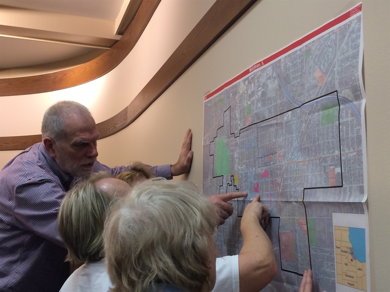
Community residents discuss where stormwater creates issues when it rains.
 By Josh Ellis and MPC Research Assistant Kelsey Pudlock
 - April 1, 2015
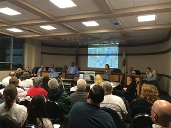
With spring around the corner, the Village of Midlothian is getting ready…RainReadySM! RainReady is an initiative started by the nonprofit Center for Neighborhood Technology to help residents and communities work together to plan, coordinate and find solutions to water-related problems that are influenced by climate change. Residents—including members of Midlothian’s well-known advocacy group, Floodlothian Midlothian—packed into the Village Hall on Thursday evening, March 11, 2015, to kick off the start of Midlothian’s transformation into a RainReady community. As dedicated members of the Calumet Stormwater Collaborative, Center for Neighborhood Technology seeks to bring the RainReady initiative into communities in the Calumet region that could benefit from their tools and services.

Kelsey Pudlock
In partnership with the U.S. Army Corps of Engineers, Center for Neighborhood Technology is developing a RainReady plan in the Village of Midlothian, the first of its kind. Thursday’s public meeting was a way to introduce the concept, inform the Village of the partnership’s preliminary findings, and provide relevant updates on efforts to alleviate Midlothian’s flooding problems.
At the meeting, I learned that the waves of Lake Chicago—a prehistoric ancestor to Lake Michigan—lapped ashore along the northwest portion of the Village—right where Natalie Creek is channelized into a sea of concrete and notoriously spills into the streets at 149th Street and Kilpatrick Avenue whenever it rains. The ancient shoreline is at the exact location where members of the Calumet Stormwater Collaborative were taken on their tour of Midlothian’s most flood-prone areas in January 2015.
According to Center for Neighborhood Technology’s current survey results, flooding happens often and in the same places. It is even perceived as a shared and private problem where the water is transferred between neighbors. The U.S. Army Corps of Engineers has found that, in addition to embankments overflowing, flooding is also a result of sanitary sewer backups, storm sewer backups and a naturally high water table in one portion of the Village’s neighborhoods.
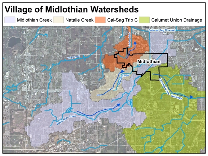
These are the issues collectively affecting residents at the street or neighborhood scale, but the Army Corps also pointed out that Midlothian is intersected by four watersheds—Midlothian Creek, Natalie Creek, Calumet Union and the Cal-Sag Channel—which all sit under other neighboring municipalities. In other words, the problem isn’t particular to Midlothian, and neither is the solution.

U.S. Army Corps of Engineers
The fact that the Metropolitan Water Reclamation District of Greater Chicago is looking at flooding solutions outside the village limits clearly illustrates that managing stormwater requires inter-jurisdictional action. Residents were excited to hear that some of the alternatives the District is evaluating are located in Midlothian as well as upstream of the community, particularly in Oak Forest where past land use and water management decisions have had a significant influence on how—and how much—water flows downstream into Midlothian. The District proposed detention basins in Oak Forest as well as within Midlothian.
However, the realization that Oak Forest would have authority over the management of upstream detention basins caused a great deal of frustration. Many residents felt that Oak Forest would be incapable of managing a detention basin in a way that would benefit Midlothian because of the way they currently manage a basin that contributes to Natalie Creek’s inundating water levels during storm events. After this discussion, it is evident that public officials across both municipalities will need to work together to align stormwater management protocols—from both a policy and operational standpoint—as well as build a significant amount of trust across the two communities.
Even though residents applauded Metropolitan Water Reclamation District at the end of their presentation, there still is a sense of discomfort looming over Midlothian. Much of this discomfort stems from two earsplitting words—economically feasible. In other words, the Water Reclamation District is still determining which of the alternatives will afford economic benefits that outweigh the economic costs. While many of the residents would love a pocket park that captures their stormwater, more green space and increased quality of life in the community, they recognize the reality that the most desirable and effective solutions can be costly, and therefore may not actually get built.

Kelsey Pudlock
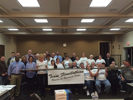
Center for Neighborhood Technology, U.S. Army Corps of Engineers, Metropolitan Water Reclamation District of Greater Chicago, Floodlothian Midlothian and others after the meeting
Nevertheless, the hope is that Center for Neighborhood Technology and the Corps’ RainReady Plan will identify stormwater solutions that are affordable and effective. One challenge for the partnership will be to figure out how a RainReady plan, which focuses just on community-based strategies, will turn Midlothian into a RainReady community, when in reality their flooding comes from and reaches beyond their municipal borders. Perhaps a more rain-ready community is a rain-ready watershed, where every community has a RainReady plan that identifies common stormwater management goals. If a RainReady plan is developed without a shared understanding of the problem across municipal borders, the effectiveness of the plan could be dramatically reduced. As the Calumet Stormwater Collaborative moves forward into their second year with a robust work plan, RainReady will have a plethora of resources to tackle these complex challenges.