MPC uses research and data from the U.S. Geological Survey in ways that may surprise you
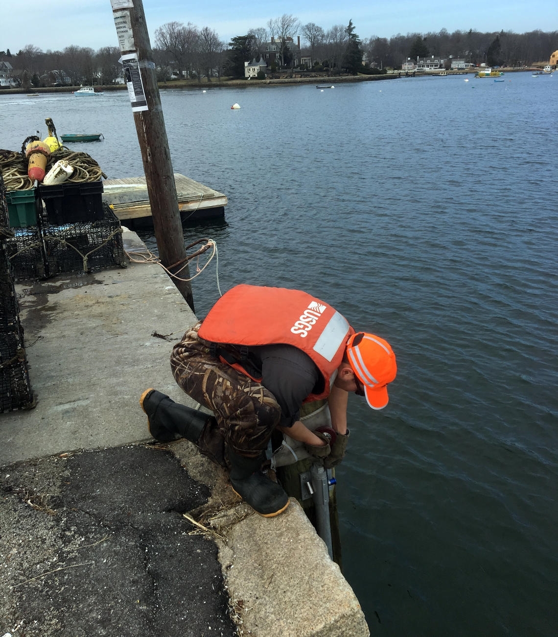
Who's this, hard at work assessing water resources?
Tweet this
The U.S. Geological Survey. Does that name make you think of rocks and minerals? You should also think about water! USGS is actually very involved with the study of water, including our nation’s surface waters and groundwater.
Last month, MPC told the USGS how the agency's work helps us
Last month MPC, along with several other organizations, was invited to share our perspectives and ideas about the work of the USGS at one of a series of meetings arranged by The National Academies, the Committee on Future Water Resource Needs for the Nation. This meeting presented a great opportunity to talk about MPC’s water resources work and how USGS and its data and research contribute to positive outcomes for area communities, businesses, and residents.
MPC framed our comments and suggestions reflecting three key areas of our work: water supply, rivers, and stormwater.
ColumbianSC.net
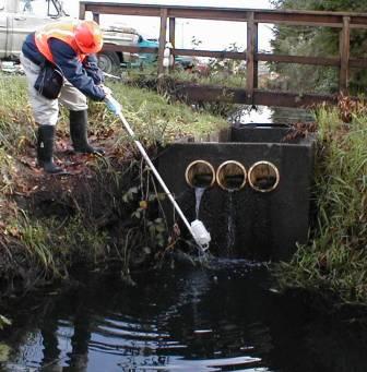
Collecting a sample to test for pollutants in stormwater
Water Supply and Groundwater. Working closely with partners, including the Chicago Metropolitan Agency for Planning (CMAP), MPC brings nearly a decade of experience assisting local communities to solve their water supply management concerns and collaborate with neighboring communities. MPC pursues policy reforms to ensure local, regional and state decision-makers have needed data about our water supplies, as well as incentives to promote prudent and innovative management approaches. Our recent release of Drinking Water 1-2-3, a guide for local officials, is a prominent example of the leadership role MPC plays in this topic area.
The National Academies Committee had asked us to address:
- What are the most important aspects of your relationship with the USGS?
- How do you utilize the work in water science and research of the USGS?
- How do you envision the future of this partnership over the next 25 years?
USGS can help us understand and address aquifer depletion
Reflecting our understanding of regional water supply issues, we highlighted that there are important concerns in our region related to both the quantity of water available, and the quality of groundwater as a source of drinking water. For example, the Illinois State Water Survey released a report in 2015 about the groundwater in northern Illinois which set off alarm bells:
- Our deep sandstone aquifers are being depleted unsustainably
- High-capacity wells could be unusable in as little as 15 years
- Many more wells could be dry by 2050
With regard to groundwater quality, we have noted that as aquifers are depleted and communities draw water from deeper aquifers, contamination issues can become more prominent. Naturally-occurring radioactive isotopes radium-226 and radium-228 are present in excess of the U.S. EPA drinking water standards.
How can USGS help?
USGS data and research can help us characterize and understand current conditions and develop effective solutions. In particular work on aquifer mapping, groundwater elevations, and trends is needed for scenario planning and decision-making. Also, mapping groundwater recharge zones can inform community land use planning and zoning.
Our Rivers Work and Water Quality. An important program area for MPC is planning to take advantage of the region’s valuable river resources. Our outreach to and dialogue with over 6,000 people in the area informed the vision for Our Great Rivers: By 2040, Chicago’s rivers will be inviting, productive, and living. There is enormous potential for Chicagoland rivers to provide social, environmental, and economic benefits.
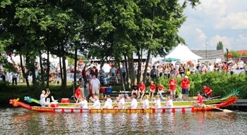
There are many opportunities for fun recreational activities on our rivers
How can USGS help?
We highlighted that making USGS data readily available and interpretable by a broad audience is an important need. If real-time data can be posted on web portals, planners can perceive trends and understand what factors cause the water resources to have higher pollutant levels. And people in the area can understand when recreation activities on and in the rivers are safe. We also offered some more specific suggestions regarding priority pollutants and monitoring and data needs.
Real-time pollutant data could alert the public on the state of our rivers, similar to Lake Michigan swim advisories
Stormwater. In our region there are wide expanses of impervious surfaces, land cover such as streets and parking lots that repel rainwater and keep it from infiltrating into the ground. The stormwater instead drains into local sewers, in large quantities. This of course leads to problems that people experience, such as localized flooding, and problems that fish and aquatic species experience, such as increased levels of pollutants and degraded habitat. Two primary tools in our stormwater management toolbox are detention – holding back water until after a rain event, releasing it when there is more capacity in the sewer system; and green infrastructure – mimicking a natural condition and allowing water to soak into the ground.
How can USGS help?
USGS
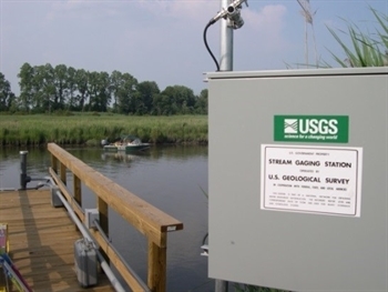
USGS Gage Stations can measure and track the amount of water flowing through a river or stream system
USGS data and research can help us plan effective solutions. For example, monitoring of green infrastructure installations can provide valuable data on how rain gardens and bioswales and permeable pavement perform over time. This can in turn inform maintenance plans and design standards for future green infrastructure installations. Also, USGS operates gage stations, which measure water level surface elevations ("stage") and/or volumetric discharge (“flow”). The changes in water levels in rivers in urban and urban areas are often caused by the release of large volumes of stormwater. Thus gage stations are valuable for understanding the effects of stormwater
USGS can help us measure the performance of green infrastructure over time
We were pleased to have the occasion to describe our work to the Committee on Future Water Resource Needs for the Nation, and to share our thoughts and suggestions about priority areas for USGS monitoring and research in the years ahead. Jason Navota from CMAP also presented during our session, and it was conspicuous how our organizations are thinking alike. By aligning Federal, State, regional, and local efforts, thoughtfully prioritizing, and producing and sharing relevant data, communities and stakeholders in Northeastern Illinois can make sound, positive decisions and take productive actions regarding the use and protection of our valuable water resources.