Rain gardens, bioswales, and permeable pavement are becoming more common. But that doesn’t mean they’re coordinated or maintained.

MPC
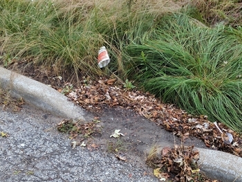
I stumbled upon this rain garden in the Village of Robbins. Are there others nearby?
Tweet this
All roads lead to Rome, and, for some communities, all gutters and sewers lead to a water treatment plant. At least they used to! Increasingly, municipalities are employing a “distributed” approach to stormwater management. Rather than moving water away from an urban environment as quickly as possible, as has traditionally been common practice, green infrastructure is used to capture rain where it falls.
Green infrastructure is infrastructure. So why aren’t we tracking and managing it?
What is green infrastructure? Green infrastructure is a class of engineered solutions which aim to mimic the landscape before human development. That is, unlike roads, parking lots or even sodded lawns, it allows water to penetrate and soak into the ground instead run off to the closest sewer drain or, worse yet, into someone’s basement! Examples include rain gardens, which use native plants and special soils to capture rain; bioswales, which are a type of vegetated ditch often running between a road and sidewalk; and permeable pavement, which allows water to penetrate and filter down through the underlying layers of gravel and stone.
By allowing some of that water to infiltrate into the landscape or evapotranspirate (evapotranspiration is the process of evaporation through plants, soils and other surfaces), green infrastructure like rain gardens, bioswales and permeable pavement lowers the volume of water which reaches the sewer, meaning less demand on the sewer system and less flooding. Simultaneously, green infrastructure filters the contaminants stormwater picks up on its way to the sewer. More than just a bunch of nice plants, green infrastructure is an important piece of a city’s stormwater management practices.
To the best of our knowledge, there is no central repository which tracks green infrastructure’s location and maintenance.
In recent years, there’s been a huge increase in the amount of green infrastructure installed throughout our region. For example, the Metropolitan Water Reclamation District and many local partners have invested millions of dollars to help communities throughout Cook County address localized flooding issues. In 2018 alone, 20 selected projects will amount to approximately $12 million in constructed green infrastructure. Similarly, the Space to Grow program has prepared 15 schoolyards in Chicago to capture and hold over 2.5 million gallons of stormwater. And yet, to the best of our knowledge, there is no central repository which tracks green infrastructure’s location and maintenance. It may exist, but in disparate locations, difficult to access and harder still to track region-wide trends or impacts.
Green infrastructure is infrastructure. So why aren’t we tracking and managing it? Our world is full of concrete infrastructure, most of which comes complete with maps and staff responsible for its maintenance. Green infrastructure such as bioswales and permeable pavement, on the other hand, is largely untracked in our region and runs the risk of not being maintained over time.
What do we lose by not knowing? And what can we do about it?
The Calumet Stormwater Collaborative (CSC) recently released it 3-year Work Plan, which lists fundamental goals of reducing non-overbank flooding, ensuring maintenance of grey and green infrastructure, more coordination across jurisdictions and better use of data-driven decision making. As a result, the CSC chose to tackle some of the questions above about the region’s green infrastructure and determine how we might document all the projects out there. With a grant from the Illinois Department of Natural Resources–Coastal Management Program, an active and longstanding member of the CSC, MPC is helping to facilitate discussions with input from a diverse group of stakeholders to help answer if an inventory of green infrastructure is needed, for exactly what purposes, and how feasible it would be to build.
“My organization, the Illinois Department of Natural Resources Coastal Management Program, is proud to have been a part of the Calumet Stormwater Collaborative since its beginnings. By partnering with the CSC, we strive to facilitate discussions about urban stormwater management and help coastal communities – in the Calumet and across Illinois – to weather climate change impacts. Our city and our coast is changing, and we need to get ready. We are thrilled to partner with Metropolitan Planning Council to build innovative ways to better prepare our communities.”
–Annie Turek, Illinois Department of Natural Resources–Coastal Management Program
What are other communities doing? Different approaches toward tracking and maintaining green infrastructure
We are happy to admit that we are not the first to think of this. Environmentally minded people in Milwaukee, WI, Illinois’ DuPage County, and elsewhere have already begun efforts to track green infrastructure within their jurisdictions. We are eager to learn from their examples and explore what approaches we might replicate closer to home:
Milwaukee, Wisconsin – Inventorying what exists to inform future planning
As part of their ReFresh Milwaukee Sustainability Plan, Milwaukee’s Office of Environmental Sustainability proposed a 10% increase in volume captured by green infrastructure annually. In order to increase the amount of green infrastructure, they first needed to know where it was and how much stormwater was being captured.
Previously, the Milwaukee Metropolitan Sewerage District maintained a Green Infrastructure Grant Application database, and there was permit data through the Department of Public Works’ green streets program. But these were both incomplete. To get a fuller picture, Milwaukee city staffers had to supplement this data with information from other green infrastructure websites, through web searches to identify green infrastructure installers, as well as a site visit.
In 2015, the city completed their Green Infrastructure Baseline Inventory and made the data available in an online map interface. The online map includes the location and type of green infrastructure as well as gallons of stormwater captured by the installations. It also includes layers that support decision making, such as watersheds, FEMA floodplains, and constraints which may make certain locations less feasible for future installations (e.g., areas with a high slope, shallow topsoil, high population density). Interestingly, they also chose to add a layer indicating upcoming street paving projects, highlighting possible synergies to install green infrastructure when the road is already torn up.
DuPage County, Illinois – Compiling a database for better stormwater modeling
The DuPage County Stormwater Management program’s goal is to reduce stormwater impacts throughout the county, protect surface and groundwater resources, and enhance the local environment. Since 2010, the program has issued more than $3 million in grant funding to support projects which provide a water quality benefit, such as streambank stabilization, rain gardens and permeable pavers.
Just like all infrastructure, green infrastructure requires maintenance. Bioswales fill with sediment, and the soils compact. Inlets clog with debris. Maintenance must be (but often isn’t) a line item in the municipal budget.
To inform their water quality monitoring efforts throughout the county, staff GIS experts compiled an inventory of assets in order to track progress and better monitor water quality. The CSC was lucky to hear firsthand how this was done! They started by compiling a list of detention basins and evaluating them for water quality benefits. This data was combined with permit information for projects previously funded through the DuPage County Water Quality Improvement Program, datasets from DuPage County municipalities, and new green infrastructure installations.
As of late 2018, the inventory was approximately half complete. As with Milwaukee’s inventory, the dataset for DuPage County will include the type of green infrastructure along with metadata for the project, including municipality, year of completion, grant amount and recipient, and more. The completed inventory will be used in pollutant load reduction modeling, and to inform analyses of larger trends in the county.
Why bother inventorying green infrastructure?
In both Milwaukee and DuPage County, before undertaking efforts to compile a central repository of green infrastructure, the data existed but in an incomplete and difficult to access format. Using the baseline inventory of existing green infrastructure, Milwaukee’s Office of Environmental Sustainability and DuPage County Stormwater Management are able to make data-driven decisions about where to place new green infrastructure and have the greatest impact. This allows them to direct investment strategically while maximizing benefits as they work to reach their goals, whether that is a specific increase in stormwater capture rates or more general water quality improvements.
Does northeastern Illinois need a green infrastructure baseline inventory?
MPC
Bioswales like this one need regular maintenance to ensure proper functioning.
Just like all infrastructure, green infrastructure requires maintenance. For example, bioswales fill with sediment, and the soils get compacted. The inlets become clogged with debris and need to be cleaned out. The plants should be inspected regularly and changed out if they’re not healthy. Maintenance must be (but often isn’t) a line item in the municipal budget. Staff needs to be trained in its upkeep. And green infrastructure has a lifespan… just like any other asset!
If we’re not tracking and maintaining it, we could be compromising the resilience of our region and letting precious investments go to waste. Green infrastructure is designed to be an integral component of our region’s stormwater management efforts. It’s time to begin valuing it because it is valuable. This starts with knowing where it is and knowing its condition.
Check back soon for updates on the CSC’s efforts to assess the need for and feasibility of tracking green infrastructure in the region!