
Metropolitan Planning Council
Entering Canal Origins Park in Pilsen, on Chicago's Southwest Side, from Ashland Avenue
If you’ve ever tried it, you know that getting to the riverfront in Chicago’s Pilsen neighborhood can be a trip. There aren’t many places to access it, and you have to know what you’re looking for to find them. On Friday, July 10, myself and a couple other Metropolitan Planning Council (MPC) staff explored one of those places on a small group walking tour of Canal Origins Park and the Canal Port Riverwalk, both nestled in the Lower West Side of the city between Pilsen and neighboring McKinley Park.
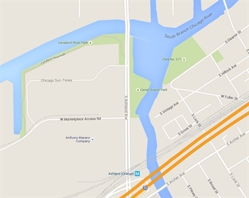
Google Maps
Canal Origins Park and Canalport River Park, on either side of Ashland Avenue on Chicago's Southwest side.
The tour was hosted by Tiffany McDowell of Adler University’s Institute on Social Exclusion and Center on the Social Determinants of Mental Health. Tiffany invited MPC to this walk to fill community members in on our Great Rivers Chicago initiative and to hear their ideas on improving their riverfront. The goal of Great Rivers Chicago, an effort by the City of Chicago, MPC, Friends of the Chicago River and others, is to incorporate residents’ feedback and existing plans into a coordinated, long-term vision for our rivers.
Pilsen is a predominantly Mexican neighborhood on Chicago’s Southwest Side known by many for its art galleries, public murals and taquerias. Despite the fact that the South Branch of the Chicago River spans the entire east-west length of the community, it is not known for its riverfront. That is because the stretch of the South Branch of The Chicago River that runs through this area is dominated by the Pilsen Industrial Corridor, a cluster of massive industrial facilities.
Despite the fact that the Chicago River spans the entire east-west length of the community, Pilsen is not known for its riverfront.
One of these facilities is the recently shuttered Fisk coal plant. This plant contributed to juvenile asthma as well as premature deaths and has helped to form a barrier between the Chicago River and residents in neighboring communities. A company called NRG Energy now owns the Fisk coal plant site and is in talks with the city about how to develop it. The Chicago Transit Authority recently signed a deal with NRG to begin exploring the possibility of using this site as a bus garage. This rare riverfront development opportunity is yet another reason why local residents and community organizations are turning even more attention to the future of their riverfront, which has historically been highly inaccessible.
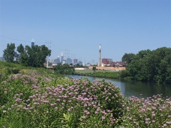
Metropolitan Planning Council
The shuttered Fisk power plant is just across the Chicago River from Canal Origins Park.
One of those engaged residents, Nelson Soza, joined us for the tour. Nelson is a long-time Pilsen resident and executive director of the Pilsen Alliance, a grassroots community organization that addresses community issues on behalf of low- and moderate-income households in Pilsen. One of those issues includes development without displacement. Nelson has a vested interest in the development of the Fisk plant site—he was even a member of the Fisk plant reuse task force.
The Canal Port Riverwalk is located on the west side of Ashland Avenue while Canal Origins Park is on the east side, just north of the Stevenson expressway. They are among the few public access points along the river in this part of the city and are truly hidden gems. I’ve driven by that block many times and never noticed either of them, perhaps because cars drive down that stretch of Ashland at pretty high speeds.
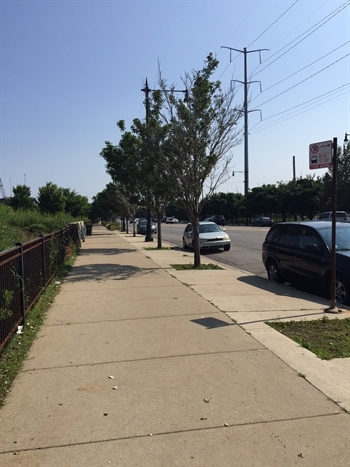
Metropolitan Planning Council
The entrance to Canal Origins Park is easy to miss because it's located on a stretch of Ashland avenue where cars drive by at high speeds.
We started the tour at Canal Origins Park, one of the city’s 50 Park District Nature Areas, covered by six-foot-high native plants and grasses. The park was built in 1848 to commemorate the Illinois and Michigan Canal—later rendered obsolete by the Sanitary and Ship Canal and now defunct—which connected the Mississippi River drainage basin to the Great Lakes. The site's historic significance granted Canal Origins Park landmark status in 1996.
To get to the riverfront, we walked down a concrete path that felt like a hallway because of the tall walls of lush native plants along either side. There were a few benches, most of which were rusted and broken, and despite signs that warn against fishing, there were fishing pole stands. During our visit, we saw only a handful of people walk by, including a woman on a walk with two small children. Tiffany and the Pilsen residents on the tour said that the park is not a popular destination because it is often desolate, littered with trash and perceived as dangerous. Residents on the tour told us that they’d like their neighborhood riverfront to look and feel more like Ping Tom Park, just down the river in Chinatown. Tiffany shared some ideas that have been percolating around partnerships to improve the park, but nothing has been confirmed.
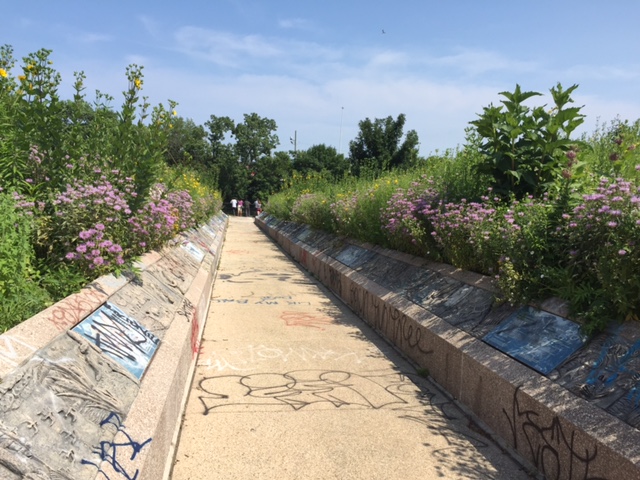
Metropolitan Planning Council
The path to the riverfront at Canal Origins Park.
Next we walked across Ashland Avenue to see the Canal Port Park and Riverwalk, a well-manicured greenway with seating and no trash on the ground. The park, owned by the Park District since 2002, was built in the mid 90s after the city bought a former Sears warehouse and redeveloped the site. The redevelopment included the creation of an industrial park and the sale of land to other prominent businesses. While we were there, we saw one other person, a police officer in uniform on his bicycle. On a beautiful Friday afternoon, I expected to see more visitors to this riverfront park.
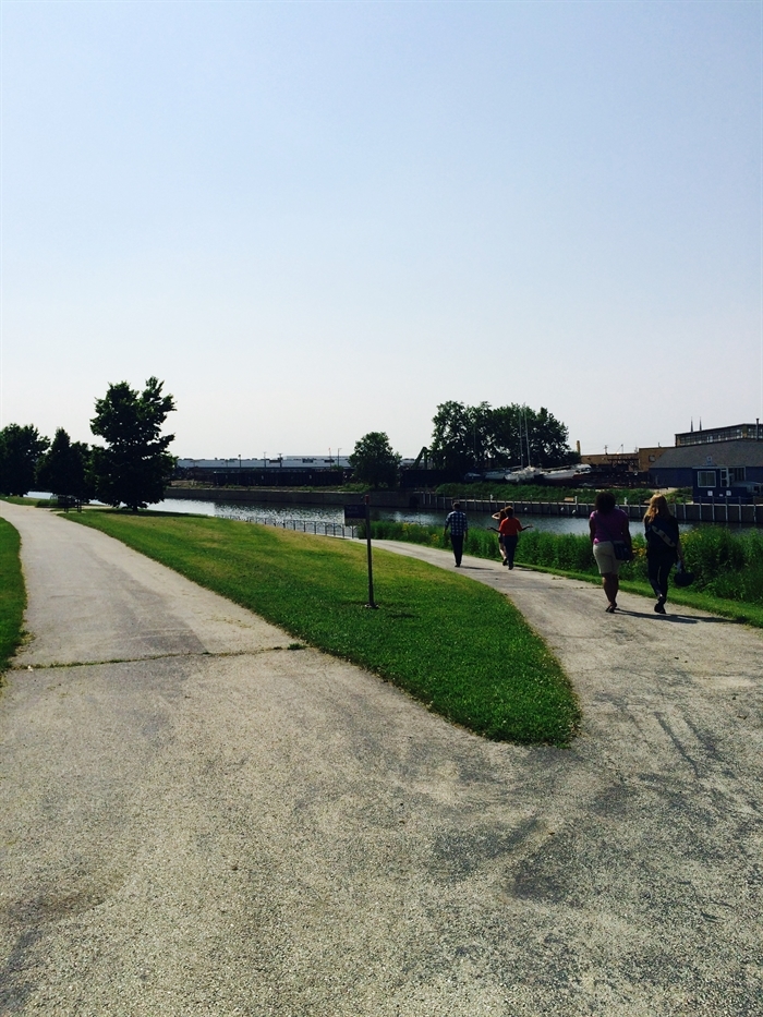
Metropolitan Panning Council
Canalport River Park, across Ashland Avenue from Canal Origins Park
Groups like the Pilsen Alliance are excited about any opportunity to have the community weigh in on the development of riverfront parcels. We heard that the two main questions the community has about the river are: 1) How do we get there? and 2) Is it clean? MPC hopes to partner with Adler University, the Pilsen Alliance and many others to help answer these questions and to inform the plan that we are developing for Great Rivers Chicago.